The Log of Moira
Central America (February -- May 2006)
These are mostly Susan’s remarks. Larry’s notes are indicated thus <Larry: blah blah blah.>.
I am writing this narrative from the modern, quite lovely Puerto Lucia Yacht Club in La Libertad, Ecuador where the weather is cool and overcast, much like a "June-gloom" day in Southern California. Surprised? We are very close to the Equator, but thanks to the cold Humboldt current and that this is the dry “winter” season in the Southern Hemisphere we are enjoying very pleasant weather.
We undertook the difficult and sometimes rough passage to Ecuador for two reasons. The first one was the weather: Central America is now hot and much of it is very humid, very rainy, and full of lightning storms. Second, we wanted a place to leave the boat from which we could at our leisure explore South America. Ecuador fulfills both of these goals.
Before I get us to Ecuador I want to fill you in on our passages in Central America. I left you all in Huatulco, Mexico when I last wrote our journal, so let’s go back as I fill in the gaps between Huatulco and Ecuador.
In our last report we pointed out that Zihuatanejo is as far
south as most cruisers get in Mexico. After “Z-town” the sailing gets more
difficult, and the weather less certain. Huatulco is like that last look around
in Mexico for the cruiser who actually got beyond Z-town. You get one last
chance to be certain you want to go forward. Larry and I had planned to see
Central America after Mexico, and wanted to be in Ecuador by the middle of May.
We did think about the passages we might have and the rougher sailing we might
experience beyond both Z-town and Huatulco, but we really had already decided
to go onward. It was late January when we were ready to leave Huatulco. 
Gulf of Tehuantepec
Huatulco is on the western edge of the Gulf of Tehuantepec, which along with Costa Rica’s Golfo de Papagayo are considered the “two terrors of Central America.” These two gulfs are infamous to sailors who have made the passage along the Pacific Coast between Mexico and Costa Rica because of the gale force winds that are habitually present in both areas. While weather forecasts are available for both areas, the force and unpredictability of both of these winds can be terrifying to the unprepared cruiser.
The winds are not local to the areas. The Gulf of Tehuantepec is most influenced by the weather in the Gulf of Mexico while the Gulf of Papagayo is influenced by the weather in the southwestern Caribbean. The pass across each narrow isthmus in these areas funnels these winds from afar, over the interiors, and out over the coastal areas to wreak havoc on voyagers along the Pacific Coast. Strong winds in these Gulfs are not occasional or isolated. The Gulf of Tehuantepec blows an average of almost 20 days a month with winds of force 7 (30 knots, about 35mph) or above. The Gulf of Papagayo blows with winds of force 7 to 8 for five to ten days at a time. Gale force winds occur with greater regularity between November and April . These months are the time most cruisers cross, not out of masochism <Larry: or machismo> but because the rest of the year is the rainy season and hurricane season of Central America, with winds, rains and electrical storms considered by most cruisers to be worse than the winds of November to April. <Larry: Also, after April, those traveling further south than Costa Rica more often encounter winds from the south, i.e., the direction one would like to be going. Contrary winds make the passage slower and more trying. More on this point later.>
It’s important to keep in mind that most cruisers (us included) consider winds over 25 knots to be uncomfortable and something to avoid. Gale force winds are 34 to 45 knots. In this area the winds typically accelerate with little notice, in clear weather, without cloud buildup or major changes in the barometer. Cruisers rely on good weather reports to determine the best opportunity for a safe and comfortable passage across these Gulfs. But weather reports are not perfect, and these winds are often unpredicted. Much better information is available about the Gulf of Tehuantepec than the Gulf of Papagayo, mostly because the Tehuantepec’ers originate in the Gulf of Mexico where weather forecasters have access to a great number of weather indicators: weather buoys and actual ships in the areas providing weather reports. The tools available to us and fellow cruisers include weather web sites, SSB weather faxes, and cruisers’ nets during which amateur weather experts provide up-to-date weather forecasts to listening cruisers. These amateur experts are cruisers, for example one who reports from his home in Ventura, another from his sail boat in Panama. Larry also uses our SSB and Iridium satellite phone to download weather faxes from various sources including the US National Weather Service.
In Huatulco, we also listened carefully to the harbor master, Enrique, to find out what the Mexican Navy was reporting. From all reports there came a time at the end of January which looked like a very good “weather window” of 72 hours to cross the Tehuantepec. So, off we went with six other cruising boats to test the Tehuantepec. We motored across the Gulf with light and variable winds (5 to 10 knots, from any direction at all). We had found a good weather window and made haste across the Gulf while we had the chance. Larry would have liked to sail when the winds came up to 20 knots but I must admit that I was pleased to motor and get out of the Gulf as quickly as possible. The key to this passage is to be prepared to wait for a perfect weather window and then move as fast as you can to get across. While the window can close without notice, and sometimes before predicted, the window held open for us and we accepted the luck with equanimity. The Tehuantepec is about 260 nautical miles across, so this was a two-and-a-half day passage for us.
<Larry: Because the seas are flatter close to land when one has an offshore wind, the often-cited strategy for crossing the Tehuantepec is “one foot on the beach.” The idea is that by being within a mile (or half a mile, or a few hundred yards) of the shore, one can suffer the wind in relative peace because the waves are small. It’s almost always the water that does the damage, not the wind. The tradeoff here is that one moment of inattention will drive one’s ship onto the shore, and probably destroy her. You pays your money, and takes your risks: one or two boats go up on “the beach” every year. We had a slick calm, and went far offshore. However, see below for our very different experience off of Nicaragua.>
 At the far end of the Tehuantepec is the last
port in Mexico, Puerto Madero, which is a possible stop for cruisers <Larry:
one can also divert to Salina Cruz, in the very throat of the Tehuantepec>
but we were anxious to get on our way to El Salvador, and had good conditions.
We knew we could stop in Puerto Quetzal, Guatemala, if we were very tired. But
as we continued this passage we got our sea legs and felt rested so we passed
the coast of Guatemala in the early morning with the coastal volcanoes
appearing as golden globes against the horizon as they were silhouetted by the
rising sun. <Larry: The whole passage from Huatulco to Barillas in El
Salvador was about 470nm, our longest passage to date. It’s a paradox, but this
five-day passage was in some respects easier than our two or three-day
passages. It seems that it takes about two days to get into the rhythm of a
passage, so that, under reasonable conditions, one can go off watch and
immediately fall asleep. The proof here is that on the fourth day of our
passage, Susan was in the galley baking bread.>
At the far end of the Tehuantepec is the last
port in Mexico, Puerto Madero, which is a possible stop for cruisers <Larry:
one can also divert to Salina Cruz, in the very throat of the Tehuantepec>
but we were anxious to get on our way to El Salvador, and had good conditions.
We knew we could stop in Puerto Quetzal, Guatemala, if we were very tired. But
as we continued this passage we got our sea legs and felt rested so we passed
the coast of Guatemala in the early morning with the coastal volcanoes
appearing as golden globes against the horizon as they were silhouetted by the
rising sun. <Larry: The whole passage from Huatulco to Barillas in El
Salvador was about 470nm, our longest passage to date. It’s a paradox, but this
five-day passage was in some respects easier than our two or three-day
passages. It seems that it takes about two days to get into the rhythm of a
passage, so that, under reasonable conditions, one can go off watch and
immediately fall asleep. The proof here is that on the fourth day of our
passage, Susan was in the galley baking bread.>
While there is much to see in Guatemala, including the lovely colonial city of Antigua, we will have another chance to see the sights of Guatemala from the Caribbean side. Beside, there were another two hundred miles to go to get to El Salvador. <Larry: We had a new experience off the coast of Guatemala: the katabatic (downslope) winds of midnight. About midnight or 2AM, the winds would suddenly rise from the 15kt range to maybe 30kt for a couple of hours. For a well-found boat, already reefed, this was not much more than exciting, and we made huge progress because the winds were on the beam. Because the wind was off the land, the seas were flat, and we roared along. In some respects, this was a preview of our experience to come off of Nicaragua. About 4AM the winds would drop again and we would be left to work our way more slowly toward our destination. But Susan was terrified by these winds.>
One old <Larry: very old> experience was disentangling ourselves from the polypropylene longlines laid out by the fishermen. The night we transited the Guatemalan coast, we got ourselves caught in half-a-dozen of these lines. The first notice was usually that the boat’s speed dropped to nil. After some dignified incredulity, we would begin fishing around the rudder with the boathook, and often would come up with a blue poly line. We tried to disengage without cutting the line, or failing that, to cut the line and tie it back together before dropping it astern.
El Salvador
 <Larry:
When we entered Salvadorian waters, we hoisted the first of our home-made
courtesy flags (we had used a store-bought courtesy flag for Mexico). We had
spent an afternoon together over the saloon table in Huatulco cutting, pinning,
and sewing the flags we’d need for El Salvador, Nicaragua, and Costa Rica from
heavy acrylic fabric. Quite a bonding experience. Fortunately, the courtesy
flags for these countries, and of Ecuador, are simple, without elaborate
insignias. But it was expensive way to save money. It is not obvious, but the
maritime courtesy flag of a nation is sometimes not identical to its national
flag. Along this stretch of coast, the courtesy flag is often the national flag
minus some seal or insignia, and so is simpler to make for oneself. Because the
national flags of several Central American countries are identical except for
the seal, this means that one can sometimes get away with one flag for two
consecutive countries, e.g., Columbia and Ecuador, El Salvador and Nicaragua
(and in a pinch, almost, Honduras).
<Larry:
When we entered Salvadorian waters, we hoisted the first of our home-made
courtesy flags (we had used a store-bought courtesy flag for Mexico). We had
spent an afternoon together over the saloon table in Huatulco cutting, pinning,
and sewing the flags we’d need for El Salvador, Nicaragua, and Costa Rica from
heavy acrylic fabric. Quite a bonding experience. Fortunately, the courtesy
flags for these countries, and of Ecuador, are simple, without elaborate
insignias. But it was expensive way to save money. It is not obvious, but the
maritime courtesy flag of a nation is sometimes not identical to its national
flag. Along this stretch of coast, the courtesy flag is often the national flag
minus some seal or insignia, and so is simpler to make for oneself. Because the
national flags of several Central American countries are identical except for
the seal, this means that one can sometimes get away with one flag for two
consecutive countries, e.g., Columbia and Ecuador, El Salvador and Nicaragua
(and in a pinch, almost, Honduras).
One must fly a yellow “Q” or quarantine flag below the courtesy flag until entry formalities have been completed. Boats that forget to fly the “Q” flag have sometimes been accused of trying to sneak into a country, and fined Big Bucks.>
There are two well-known stops for cruisers in El Salvador. Both require using the services of a pilot boat (panga) to cross the breaking waves of a river bar into the area in which the marina or anchorage lies. We chose Barillas Marina after reading an article friends of ours wrote on the other area, Bahía del Sol. The crossing of the bar or shoal in Bahía del Sol is a touchy proposition: some boats are successful while some are not. The incidents are not fatal but have caused enough damage to props and rudders that we were just not interested. <Larry: In the past, entry to and staying in Bahía del Sol has been free, a prime reason why many cruisers have elected to stay there. Recently, Bahía del Sol has started to charge for its pilot services and other arrangements. It will be interesting to see whether that change results in a transfer of business to Barillas Marina Club, 20 miles further down the coast.>
We arrived at Bahía de Jiguilisco (Barillas is up the river from the Bahía) in 28 knots of wind and called the marina for a pilot on our VHF radio. Soon we met our pilot who was to take us through the shoals to the safety of the river. The wind caused significant breaking waves, through which the pilot boat picked a safe path, and Moira followed. Larry was at the wheel while I finally sat down not wanting to look back any more. The sea was a giant washing machine with large waves trying to chase us from behind as we rolled ahead of the surf following the pilot panga. The pilot knew just where the channel was and guided us through the surf safely and quickly. <Larry: In the midst of this, our pilot was called away to assist in rescuing a couple of kids who had been out fishing in the ocean when their panga capsized. I sympathize with the lifesaving mission, but it was a nervous moment for us.>
Barillas Marina Club is a private club built by a group of wealthily Salvadorian investors. <Larry: The President of the Republic is a member.> How or whether the investors make a return on this investment is not clear. The premises appeared to be a private playground during the weekends for the families of the investors, but there were not many around even on weekends. The few cruisers who came certainly did not make it a going concern. When we were there, four or five boats were there, but after our inland tour only one other boat and Moira remained. It appears that the country was so damaged by the long war that the wealthy in the country have built this type of facility to have somewhere to vacation in some peace. Adjacent to the marina is a shrimp processing factory and a large shrimp fleet, supported by a shipyard geared to keeping the shrimp fleet running. We never did get the full story on the investment or whether the marina and the shrimp facility were financially related, though the management of the two communicated well and allowed cruisers to take advantage of the shrimp and the yard that supported the shrimp boats. The marina—which actually consisted of moorings and places to anchor, no slips—has numerous amenities including a good restaurant, pool, grass-runway airport, hangers for planes and boats, cottages around the property for rent, a fuel dock, and all the immigration and customs officials needed to check into and out of the country for the cruisers.
The entire marina area was enclosed by barbed wire fencing
and was guarded 24 hours a day by armed guards with automatic weapons. This
bothered some cruisers because they felt like they were in a cage. <Larry:
Some cruisers were freaked out by the presence of the armed guards on every
corner.> I felt very safe and well protected and came to realize that the
presence of all the guards in this country <Larry: armed guards for a McDonald’s?!>
was a short-term economic  development
strategy for full employment. After all, this country had been at war for
almost 20 years, with peace accords signed in 1992. The soldiers who are now
young adults spent their adolescent years in war and knew weapons but not much
else. The peace accords allowed both sides to keep personal weapons, so turning
soldiers into guards makes some sense. Keeps everyone polite and calm! Twice a
week the marina provides a van to the nearest large town, accompanied by an
armed guard. We were free to roam the city on our own, especially the large and
vibrant mercado. We did not feel the least bit intimidated or afraid, in
fact, just the opposite. The Salvadorians were friendly, helpful, and patient
with my poor Spanish as I shopped for supplies and tried to ask about unusual
fruits and vegetables.
development
strategy for full employment. After all, this country had been at war for
almost 20 years, with peace accords signed in 1992. The soldiers who are now
young adults spent their adolescent years in war and knew weapons but not much
else. The peace accords allowed both sides to keep personal weapons, so turning
soldiers into guards makes some sense. Keeps everyone polite and calm! Twice a
week the marina provides a van to the nearest large town, accompanied by an
armed guard. We were free to roam the city on our own, especially the large and
vibrant mercado. We did not feel the least bit intimidated or afraid, in
fact, just the opposite. The Salvadorians were friendly, helpful, and patient
with my poor Spanish as I shopped for supplies and tried to ask about unusual
fruits and vegetables.
<Larry: My enduring memory of Central America is of cane ash. The banana industry died in Central America of the Panama banana disease and rising labor costs. The primary agricultural crops that remain are coffee and sugar cane. The ruins of the old, pre-war, banana industry are found everywhere across the countries we visited. The cane fields are typically tended by subsistence laborers, whose primary capital assets are their machetes. Because of the climate, cane grows, and is harvested, year-round. On any road, one will pass cane fields in any stage from freshly-planted to freshly-harvested. The day before they harvest a cane field, they set fire to it, to burn off the leaves, leaving only the cane itself. The fires at night give a Dante-esque glow to the sky. The ash from the cane floats high into the atmosphere and drifts for many miles. Two or three times a week we would come on deck in the morning to find a layer of cane ash on the deck. Fortunately, it was not a greasy ash, and washed off without stain, but it did clog the scuppers (deck drains), and an unattended boat in the rainy season could have had severe problems as a result of clogged scuppers, including a cockpit full of mosquito-infested water. Sinking due to cane ash is not inconceivable.>
El Salvador: The Inland Tour
During our time here we were fortunate to meet Max and Alene who ran El Salvador Tours. We were able to book their very last tour, as both were taking jobs with the American embassy and closing their tour business. They were able to give us perspective on the civil war that divided this lovely country for 20 years and probably lost them 50 years of development progress. Alene's family fled El Salvador for 8 years during the war and lived in Northern California. Assassination attempts were made against her parents and an uncle, and she narrowly evaded an attempted kidnapping. The ugly truth about the war seems to be that the political and philosophical struggle was a proxy war of Russian communism versus American capitalism. Alene told us that at the height of the war 1 million dollars of war equipment arrived in the county every day in the familiar workhorse US military C-10’s. <Larry: Alene showed us a spot on the Pan-American Highway that had been specially widened to a 10-lane highway. Why? To serve as a CIA landing strip. The white airport runway striping paint could still be seen.> How the Soviet assistance arrived was not revealed but there certainly were two sides and both were well provided for. Today, the political parties still espouse the old theories but both are more middle-of-the-road. Territories in the country and cities are profusely painted in the colors of the locally-dominant political party. The colors appears on the ballots to identify the parties to those in the population who are illiterate. <Larry: So, red for the FMLN (communist), green for the ecology party, and red/white/blue for the Arena (right) party. In the US, an “X” through a name would be a graffito in insult to whatever was crossed out. In El Salvador, it means, “Mark your X” (vote) on this color.” It was a shock to see “FMLN” posters on the streets. But they’re more of a leftist party now than a group of armed thugs. Alene (who, remember, was forced to flee the country), said that some of their mayors are doing good work in their counties.>
<Larry: The CIA reports that the GDP per capita in El Salvador was $4,900 in 2004, with 36% of the population living below the (locally defined) poverty line, and a life expectancy of 71 years. By comparison, Mexico had a GDP per capita of $9,600 in 2004, 40% below the poverty line, and a life expectancy of 75 years.>
We spent a night in the capital San Salvador. San Salvador stands out as the most sophisticated city we’ve seen in Central America. Physically it was mostly 3 and 4 story buildings, intermixed with a mid rise every so often. Lots of retail and restaurants on the ground level. The city is built around several hills so some of the views are of the city and lovely valleys nearby. Elevation is about 2,500 feet so it is pleasant and not too hot or humid. People are well dressed and look prosperous. The buildings are in good repair and the streets are well maintained including sidewalks. Many of the residential areas behind the main city streets are shaded with trees and tropical plants abound. Much of the protection devices of the war still remain. While the walls around properties are typical of the countries here as with Mexico, here protection includes barbed concertina wire and armed guards. We stayed in a B&B converted from a large private home. The home had walls around it while inside the large garden area made the rooms and central areas feel spacious and open to the weather and the colors of the gardens.
We visited the main archeological site of the country, which has undergone some research and evacuation. The site, ”Joya del Ceren,” is part of the long string of Inca ruins that flow through Central America. Much is yet to be done on this site and others but there are just not the funds to focus on this type of luxury, although it could increase tourism.
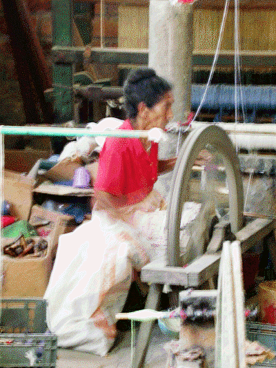 Also
on the tour was a visit to the city of Suchitoto. Once almost abandoned, this
village was restored by the interest and attention of a local artist who made
the village the home for his studio and school for painting. Weaving was a part
of the town’s history as well. Using a cooperative as the mechanism to generate
interest in weaving and painting, the town has become a regular stop for
tourists. We bought a bright intricate weaving from an 80 year old women who
spent her day in the cooperative’s building weaving on an ancient lap loom
similar to those used in the 1500’s. She charged us $10 for the weaving that
probably took her three days to make. We use it frequently as a table cloth for
the table in our cockpit where we eat under the stars most nights while
anchored or in a marina.
Also
on the tour was a visit to the city of Suchitoto. Once almost abandoned, this
village was restored by the interest and attention of a local artist who made
the village the home for his studio and school for painting. Weaving was a part
of the town’s history as well. Using a cooperative as the mechanism to generate
interest in weaving and painting, the town has become a regular stop for
tourists. We bought a bright intricate weaving from an 80 year old women who
spent her day in the cooperative’s building weaving on an ancient lap loom
similar to those used in the 1500’s. She charged us $10 for the weaving that
probably took her three days to make. We use it frequently as a table cloth for
the table in our cockpit where we eat under the stars most nights while
anchored or in a marina.
Tortillas: You may remember that I loved the Mexican tortillas which are made from maiz (corn). I gave 2 stars to the tortilleria in San Blas, Mexico as the best we tasted so far. Of course one can get fresh tortillas in the grocery stores (even Wal-Mart) or buy the maiz (corn flour) dough and make fresh ones at home on your own grill. Tortillerias exist on almost any major street, just like a bread shop in Europe. Families buy tortillas by the kilo for the families’ dinners. Tortillas don’t last much more than one day, so the day old ones are often used like lasagna noodles to make a kind of lasagna usually using left over salsa and meats, onions or anything on hand. This dish is called chilaquiles, served for breakfast and very tasty. Mexicans do not eat flour tortillas and look at you oddly if you ask for them. Once I learned to eat corn tortillas with some salt, I have not asked for a flour tortilla again. I am converted. <Larry: a quesedilla is a tortilla folded in half around some melted cheese, perhaps with some salsa or meat filling. A gringa (literally, female gringo) is a quesedilla made with a flour tortilla. Snicker…>
So I was very interested in whether the tradition of delicious tortillas would continue through Central America. We found that in El Salvador and Nicaragua thicker, maiz tortillas were served with some fish and meat dishes. Both countries have their own version of fajitas in which corn tortillas, but thick and not very flexible, were served. Not near as tasty as the Mexican version which is light and very thin. But once we got to Costa Rica, we did not see tortillas. We found that we could buy freshly made tortillas in the mercado in El Salvador but the tortilleria we found was the only one in the mercado. In Mexico, there would be several choices for purchase of fresh tortillas in that size of mercado. Of course, much corn is grown in Mexico given the demand for maiz flour. In the rest of Central America the major crops, probably out of necessity, are sugar cane, coffee and cocoa.
Nicaragua
Once we returned from our inland tour of El Salvador we were ready to go on to Nicaragua. This country has had a long civil war. The reasons seem to have been that for the last 50 or so years one family, the Somoza's, have held Nicaragua as their own fiefdom using the country’s residents like serfs to secure the best possible return on the limited agricultural resources of the country: lots of sugar cane, coffee, cocoa and bananas (before the Panama banana disease killed off the banana crop). Eventually local leaders like Ortega saw the opportunity to get rid of the Somoza’s and take over the country themselves. Certainly there is now a capitalist bent to economy and any type of fiefdom is gone. But lack of education, training and resources hold this very poor country in the third world classification. I do not see a way out to greater prosperity any time soon. But the people are friendly, pleasant and look well fed and generally employed. The children are in uniforms for school and elementary schooling is mandatory. Some kids do escape the system because their parents want their labor for the family instead of schooling.
We were headed for Puesta del Sol, a new marina which opened in 1997, serving the northern end of Nicaragua. It was developed by Robert Membreno, an American who spent his professional life developing a large international construction firm . He spent time trying to convince the Nicaraguan government (post Somoza) to build geothermal plants to harvest the largest resource of the country: the untapped heat energy of the many volcanoes throughout Nicaragua. He was not successful but did fall in love with the country and decided with the help of some private investors to build a marina, a resort on the beautiful but rugged Nicaraguan coast. The result is the very modern and pleasant Puesto Del Sol marina and resort. There is a small hotel, very good restaurant, two lovely pools, and room for about 40 cruising boats. This is a good place to leave a boat for long-term inland trips throughout Central America.
We would have liked to take advantage of that opportunity, but when we arrived in early March we got word that Larry’s father was very sick. With the beyond-the-call-of-duty help of “Sr. Roberto” we left quickly for Chicago. We went through Managua, the capital. You may remember that Managua came to the attention of the world with a disastrous earthquake in 1972. Bianca Jagger (wife of Mick of the Rolling Stones) went half way around the world just after the earthquake to find her mother and siblings trapped in Managua. The earthquake destroyed the city, much of which has not been rebuilt. There is progress, but most of the city was moved to a nearby area less prone to the earthquake faults in the area. The airport is modern and comfortable and allowed us, with the help of American Airlines, to make a fast trip to Chicago. We arrived in time to spend several happy days with Larry’s father, Ray, and then, sadly, he died. After the funeral, we headed back to Nicaragua loaded to the gills with boat parts. Fortunately Mr. Membreno had advised us to pack all parts in suitcases so that we looked like typical tourists coming into the country rather than yachties loaded down with boat parts. If customs sees thing in boxes, they’re likely to take an interest in you, and you may spend days getting your parts out of their clutches. Even if you wind up paying no import duties (boat repair parts are supposedly exempt) the delay can cost hundreds of dollars in hotels and meals, so it is best to come in “under the radar,” if you can. So we took his advice and walked through customs with no problems and no questions asked.
<Larry: The CIA reports that the GDP per capita in Nicaragua was $2,300 in 2004 (less than half of that even of El Salvador), with 50% of the population living below the (locally defined) poverty line, and a life expectancy of 70 years.>
Golfo de Papagayo
We were ready to go on but now we faced the second terror of Central America, that of the Papagayo winds. These winds are less well understood than the winds of the Gulf of Tehuantepec but can blow just as hard and for longer time periods. While the key is to listen and wait for a good weather window, the advice one gets and observes in looking at various weather information tools varies considerably. <Larry: One cruiser said, “Forget forecasts. The Papagayo winds are just a fact of life. Be prepared for 45 knots and you’ll find nothing to trouble you.”> We followed the advice of the weather gurus and looked at the western Caribbean reports from which these winds supposedly originate, but when those winds were light we still wound up with winds of 45 knots in the Papagayo region for almost the entire ten days it took use to transit the 250 miles affected by these damnable winds.
Fortunately for me and my overall sanity we were able to stop each night of the trip at an anchorage (so I faced the roar and noise of the winds for 8 to 10 hours each day but the anchorage gave us some rest and some peace even if the winds were still blowing). It was an amazing experience to get used to sailing with these winds. I never thought we would see such winds on the trip. What was almost funny was that during the entire trip we would each morning check into the cruisers' radio net to talk with other cruisers and to hear the weather report from Don on Tamure. Each morning he would advise of winds in the 20 to 25 knot range based on his weather information and we would say (along with two other boats facing the same coast line along with us) that the winds were already that morning blowing at 45 knots. So much for the sophistication of the weather information available in rugged, out of the way areas in the world.
 <Larry:
We checked out of Nicaragua in Puesta del Sol, intending to make a several-day
passage to Bahía Santa Elena at the northern end of Costa Rica. We set out from
Puesta del Sol and almost immediately, like 10 miles later, put in at the next
anchorage, the large commercial port of Corinto to regroup. The 35kt winds were
a bit of a surprise, and we wanted a good night’s sleep and a meal under our
belts before carrying on. The Port Captain came on the radio to inform us that
he’d be out in his launch to run us through the paperwork, but never showed up,
and we left the next morning at dawn. The next night, we anchored off a totally
exposed bit of coastline near the resort of Masachapa. There was no encircling
bay, or even a notch in the coast, but because the winds—still at 35kts—were
off the land, there was no swell to disturb our dinner or sleep. But it sure
felt naked to be out there. The night after, we put down the hook at a place known
as “No Name Anchorage”: it has a name, but that’s not how cruisers speak of it.
We spent several nights there, gathering our strength for the next push, to the
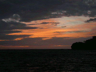
last place in Nicaragua: the town of San Juan del Sur (reputed to have the most
beautiful sunsets in Central America), where we formally checked out of the
country (again), spent the night, and the following day roared across to Bahía
Santa Elena in Costa Rica, still in winds of 35-50kts.>
<Larry:
We checked out of Nicaragua in Puesta del Sol, intending to make a several-day
passage to Bahía Santa Elena at the northern end of Costa Rica. We set out from
Puesta del Sol and almost immediately, like 10 miles later, put in at the next
anchorage, the large commercial port of Corinto to regroup. The 35kt winds were
a bit of a surprise, and we wanted a good night’s sleep and a meal under our
belts before carrying on. The Port Captain came on the radio to inform us that
he’d be out in his launch to run us through the paperwork, but never showed up,
and we left the next morning at dawn. The next night, we anchored off a totally
exposed bit of coastline near the resort of Masachapa. There was no encircling
bay, or even a notch in the coast, but because the winds—still at 35kts—were
off the land, there was no swell to disturb our dinner or sleep. But it sure
felt naked to be out there. The night after, we put down the hook at a place known
as “No Name Anchorage”: it has a name, but that’s not how cruisers speak of it.
We spent several nights there, gathering our strength for the next push, to the
last place in Nicaragua: the town of San Juan del Sur (reputed to have the most
beautiful sunsets in Central America), where we formally checked out of the
country (again), spent the night, and the following day roared across to Bahía
Santa Elena in Costa Rica, still in winds of 35-50kts.>
The second important piece of advice that we took very seriously and followed along the coast was to stay close to shore, that is, within one mile or so of the shore line. Because these winds are coming from the shore, the strategy of “one mile from shore” will not result in the boat being blown onto the shore. In fact the challenge is to keep the boat close to shore. Along the Nicaraguan coast, few dangers are present close to the coast. The area is shallow (less than 60 feet) so one must mind the navigation carefully but the result its that even though the winds are fierce, the sea is fairly flat. While the winds were terrifying to me initially Larry was challenged, thrilled and of course a very competent and able skipper to get us through this area. <Larry: Two reefs in the main, plus a flat staysail, was a potent combination. We felt sorry for the smaller boats with us who had to make it along this coast with roller-reefed jibs, which resembled nothing so much as baggy bedsheets. They went sideways when we went forward. We walked all over them. Gotta love a Valiant.> Toward the end of the coastal trip, I was getting used to these winds and they certainly had started to annoy me. <Larry: One of the transitions we look for in Susan is the transition from fear to annoyance. It is a good sign when she stops crying and starts being pissed.> The noise of these consistent winds is the worst part of the experience.
<Larry: Weather reports in the Gulf of Papagayo region remind one of Mark Twain’s lines, something to the effect of “You’ve got to love science; where else can you get such a magnificent return of speculation for such a trivial investment of fact?” The surface analysis charts of the Pacific coast of Central America may show one wind barb (i.e., one actual report of conditions from a ship at sea), usually up in Mexico, and the weather service extrapolates all of Central America’s weather from that one report, land reports, and what’s happening in the Caribbean. They have magnificent computer models, but no hard data to validate them. While we were in the Papagayo area, we never saw a forecast of more than 20 knots of wind. We never had less than 35 knots (gale force), often 50 knots (storm force), and once, 60 knots (almost hurricane force).>
Costa Rica
 We
finally came to the first anchorage in Coast Rica, called Bahía Santa Elena.
This anchorage is surrounded by a national park known for its beauty and
isolation. It was truly a lovely place but the winds howled for three days at
45 to 50 knots while we were at anchorage. JUST AMAZING. <Larry: You don’t
use the “L-word” (“leave”) in front of Susan in these conditions. Tears
result.> When the winds took a breather we could hear parrots (“papagayos”
in Spanish) in the mangrove trees and listen to the “howler” monkeys as they
climbed through the trees surrounding this very beautiful bay. <Larry: The
speculation is that the Spanish navigators named this area for parrots that had
been blown out to sea by the winds.>
We
finally came to the first anchorage in Coast Rica, called Bahía Santa Elena.
This anchorage is surrounded by a national park known for its beauty and
isolation. It was truly a lovely place but the winds howled for three days at
45 to 50 knots while we were at anchorage. JUST AMAZING. <Larry: You don’t
use the “L-word” (“leave”) in front of Susan in these conditions. Tears
result.> When the winds took a breather we could hear parrots (“papagayos”
in Spanish) in the mangrove trees and listen to the “howler” monkeys as they
climbed through the trees surrounding this very beautiful bay. <Larry: The
speculation is that the Spanish navigators named this area for parrots that had
been blown out to sea by the winds.>
Costa Rica is a tiny country, about a sixth the size of West Virginia, but is extremely varied in the wildlife and plants that exist. What sets Costa Rica apart from many other countries, particularly in this part of the world, is the lack of any military (and the lack of wars), free healthcare and education, and the 26 national parks comprising about 11% of the area of the country. In addition to the national park system, there are many wildlife refuges, biological and forest reserves, many of them private, adding up so that over 25% of the land area of Costa Rica is protected from development, farming, logging, or other exploitation. From the perspective of the sailor, the Pacific Coast in particular has many lovely anchorages along its almost 600 miles of coastline, with several marina developments that can provide services when needed.
 We
looked forward to arriving in Costa Rica because the Papagayo winds
traditionally die down about 50 miles down the coast line from the southern end
of the Gulf of Papagayo. We were even luckier. After rounding the corner from
Bahía Santa Elena and arriving in Cocos Bay located in the middle of the Gulf
of Papagayo we had one more night of the winds. Then—after facing these winds
for 10 straight days—they quietly but surely disappeared from our lives. Thank
Heaven for little gifts!
We
looked forward to arriving in Costa Rica because the Papagayo winds
traditionally die down about 50 miles down the coast line from the southern end
of the Gulf of Papagayo. We were even luckier. After rounding the corner from
Bahía Santa Elena and arriving in Cocos Bay located in the middle of the Gulf
of Papagayo we had one more night of the winds. Then—after facing these winds
for 10 straight days—they quietly but surely disappeared from our lives. Thank
Heaven for little gifts!
We spent a delightful week cruising down the coastline of Costa Rica, stopping every night at a new anchorage. <Larry: On this segment we caught our first (edible) fish, a nice yellowfin tuna, maybe 10 or 15 pounds. One of the memorable open anchorages was Bahía Uvita, protected, and guarded, by mostly unseen underwater reefs. It was a trifle breezy as we tiptoed among the landmarks, and pulled up to the windswept beach. We dropped the hook, ran out the flopper-stopper, and sought comfort in the cabin and dinner. My recollection is that we slept well.> One of our favorite anchorages was Bahía Drake (pictured), where we spent several pleasant, though rainy days, socializing with other cruisers who were making the same passage. This was our first acquaintance with the Peninsula de Osa, about which more later. Thanks to Peradventure II for the picture.>
We ended up in Golfito (the “little gulf,” so named because it is adjacent to and opens off the side of the Golfo Dulce, the “sweet gulf”), the southernmost port of the country. There we found a secure, quiet place to anchor off of the little town.
Hot and humid (at 6am, sweat poured off of us even with no effort), Golfito still has a certain charm, a rustic feeling to it. Once a big banana port, it now is regaining economic health thanks to government investment in the so-called “duty-free” shopping area which resembles a large somewhat rundown “power” mall, heavy on large appliances, watches, children’s toys and clothes, and booze. We enjoyed the cheap booze and loaded up the boat. Every quarter each person is allowed to buy $500 worth of “stuff.” At $4 (US) a bottle, good Chilean and Argentine wine entered our food chain.
 We
anchored in front of Land and Sea Services, a small marine facility geared to
cruisers and developed by Tim and Katie, two American cruisers who discovered
this area of Costa Rica 15 years ago and stayed. For $3 a day we used their
dinghy dock and front deck which was a cruising hang out. They provided
showers, cool drinks for a dollar each, telephone services, tourism services,
boat delivery services and baby sitting services for the anchored boats while
you travel inland. Laundry services were available also. Taxis are cheap so it
was easy to go shopping in the small town where most things were available.
We
anchored in front of Land and Sea Services, a small marine facility geared to
cruisers and developed by Tim and Katie, two American cruisers who discovered
this area of Costa Rica 15 years ago and stayed. For $3 a day we used their
dinghy dock and front deck which was a cruising hang out. They provided
showers, cool drinks for a dollar each, telephone services, tourism services,
boat delivery services and baby sitting services for the anchored boats while
you travel inland. Laundry services were available also. Taxis are cheap so it
was easy to go shopping in the small town where most things were available.
<Larry: There was an instructive episode during this stay, what Eileen Quinn calls the “Anchoring Dance.” We went out the morning after we arrived to get diesel fuel at the local fuel dock. When we returned to the anchorage opposite Land and Sea, the question arises: where to drop the hook? The tidal range here is 10’ or so, so, planning on the worst, in 20’ of water (at low tide) I would want to put out 150’ of chain. But our some of our neighbors use half of that. Without going into the geometry of the situation, what looks like “comfortable” may wind up being “entirely too close” when the current changes. One wants to be close to Land & Sea to take advantage of their surveillance, but so does everyone else. That afternoon we anchored and re-anchored six times before I was satisfied. Susan was in tears.>
We became particularly fond of yuca (manioc). This is a root, long with a hard glossy brown cover which can be boiled, baked or deep fried, used just like potato. Just delicious to eat.
While the per capita income of $7,500 (per the CIA, GDP per capita of $9,600 in 2004, 18% below the poverty line, life expectancy 77 years) is similar to Mexico, the country does not feel or look as prosperous as Mexico. The roads are in terrible shape. Its hard to go far along an unbroken asphalt road. Pot holes are common and irregular rugged road surfaces are the norm. There is a 12% VAT on everything sold that stands in lieu of any income tax, but roads are certainly not a priority. We found this inexplicable given the emphasis on tourism. In talking to one of our guides on our inland travel, we found that a middle-income family could buy a small three-bedroom house for $30,000, financed at around $300 a month, with insurance and utility costs requiring about $200 a month. Many families would also pay for private schooling for a least one child. Food may cost $450 a month. So our tour guide with his spouse (a teacher at a private school) took home $2,000 a month and could live very nicely on this with money left over for foreign trips each year. <Larry: He bought a catamaran while we were there.>
<Larry: Sailors sometimes say that “Good things happen slowly on a sailboat, but bad things happen quickly.” What they mean is that one becomes gradually aware that a good thing may be starting to happen, and after awareness, the process often takes a long time to come to fruition, and may disappoint. When a fair breeze comes up after a flat calm, it is at first hesitant, uncertain, tentative, unreliable. But often one becomes suddenly aware that a bad thing has already finished happening: awareness dawns when the process is (nearly) complete. Corrosion proceeds in secret, and the failure of the affected part is sudden. The first frank symptom of going aground is sudden deceleration, and maybe a crunch, though one perhaps began to drift out of the channel many minutes before. One of the reasons for preventive maintenance, inspections, and redundant navigation is to discover the secret processes before they become overt. About this time I began to notice a trickle of water in the bilge, which turned out to be advance notice that our water heater was dying.>
Costa Rica: The Inland Tour
We had planned to see some of the country on inland travels, and off we went. We took a small puddle jumping plane to San José, the capital in the center of the country. Because of the elevation, it was pleasurable to feel 80 degree (F) temperatures without the high humidity of the coast.
<Larry: In the past, we have left Moira in a marina, either in a slip or on a mooring. This was the first time we have left her overnight “on her own hook,” anchored. We enlisted the services of Land & Sea to “boat-sit” Moira, watching for any untoward events, and running the engine from time to time. When we got back to her after 10 days, she was fine.>
I found San José to be very functional without buildings of any architectural achievement. It had a feeling of rambuctiousness, sort of rough and rundown. There were many infrastructure shortcomings, particularly the disrepair of many sidewalks, and of course the streets were in bad shape. The people seem relaxed, pleasant and helpful to us. Most were dressed well in the restaurants, shops and businesses. There were many cars on the roads, many more than in El Salvador or Nicaragua. We were able to visit a beautiful, well done history museum, gold museum, and a national archeological museum. The city had many large parks but maintenance left a lot to be desired. We enjoyed a lovely dinner “alfresco” on a landscaped terrace with a fountain in a residential area not far from our B&B. Pleasant environment with a nice mix of “Ticos” (what Costa Ricans call themselves) and tourists including Americans, English and Europeans.
Rental cars are very expensive here but the country has developed a good system of shuttles and private cars with drivers that can take you almost anywhere in the country. The shuttles are usually vans, comfortable and air-conditioned but best of all reliable and coordinated and reserved on the Internet.
 Such
a shuttle met us at our hotel the next morning to drive us to Arenal Volcano,
about 4 hours north, where the largest active volcano in the country is. Arenal
was just another dormant volcano surrounded by fertile farmland until July 29,
1968 when huge explosions triggered lava flows that destroyed two villages,
killing about 80 people and 45,000 cattle. Eventually the volcano—which
retained its picture perfect silhouette—settled down and the adjoining national
park was established in 1995. The volcano produces lots of ash, boulders that
tumble down the slopes, red hot lava flows, and explosions of steam, but
scientists say there is no immediate danger as long as you stay away from the
crater. I might also point out that the forest around the volcano is full of
signs pointing out that you are walking in an area of volcanic activity which
is considered dangerous. We also stood in a large two-acre lava flow full of
large lava boulders which suddenly appeared one afternoon in 1992. Fortunately
no tourists were wandering the area that afternoon. The high point of our walk
to this lava field was an opportunity to see the toucan. Toucans are classic
rain forest birds and six species are found in the lowland areas of Costa Rica.
These birds have huge bills and flamboyant plumage. It was eerie to be that
close. The pesky volcano hid itself from us for two days; on our last day there
the top came clear for half and hour and then closed up shop as cloud cover
closed off the view. While we never saw lava, we could see and hear large
boulders being ejected from the volcano and rolling down the volcano. Most
impressive. We stayed three nights at the Montana del Fuego Inn, just outside
of the touristy town of La Fortuna. The Inn is made up of cabins with porches
facing the volcano. The porches had rocking chairs that allowed us to rock away
the late afternoons with a glass of wine looking at the volcano and watch rain
clouds move across the face of the volcano.
Such
a shuttle met us at our hotel the next morning to drive us to Arenal Volcano,
about 4 hours north, where the largest active volcano in the country is. Arenal
was just another dormant volcano surrounded by fertile farmland until July 29,
1968 when huge explosions triggered lava flows that destroyed two villages,
killing about 80 people and 45,000 cattle. Eventually the volcano—which
retained its picture perfect silhouette—settled down and the adjoining national
park was established in 1995. The volcano produces lots of ash, boulders that
tumble down the slopes, red hot lava flows, and explosions of steam, but
scientists say there is no immediate danger as long as you stay away from the
crater. I might also point out that the forest around the volcano is full of
signs pointing out that you are walking in an area of volcanic activity which
is considered dangerous. We also stood in a large two-acre lava flow full of
large lava boulders which suddenly appeared one afternoon in 1992. Fortunately
no tourists were wandering the area that afternoon. The high point of our walk
to this lava field was an opportunity to see the toucan. Toucans are classic
rain forest birds and six species are found in the lowland areas of Costa Rica.
These birds have huge bills and flamboyant plumage. It was eerie to be that
close. The pesky volcano hid itself from us for two days; on our last day there
the top came clear for half and hour and then closed up shop as cloud cover
closed off the view. While we never saw lava, we could see and hear large
boulders being ejected from the volcano and rolling down the volcano. Most
impressive. We stayed three nights at the Montana del Fuego Inn, just outside
of the touristy town of La Fortuna. The Inn is made up of cabins with porches
facing the volcano. The porches had rocking chairs that allowed us to rock away
the late afternoons with a glass of wine looking at the volcano and watch rain
clouds move across the face of the volcano.
 The
next day we journeyed to the border of Costa Rica and Niagara to the Caño Negro
Reserve, home to caimans (crocodiles) and the beautiful roseate
spoonbill bird. It has a white head with a spoon-shaped bill, and a long
wingspan tinged with pink. When a group flies or moves together from the
water’s edge, the birds resemble the pink flamingo of east Africa. We were told
that the pink tinge comes from the amount of shrimp devoured through the
spoon-shaped bill that acts as a scoop along the bottom of the shallow marsh.
Dozens of herons, cormorants, storks and ducks roamed the marsh. An ecological
threat to the area comes from the government allowing farmers to graze their
cows on the Caño Negro for a fee. The grazing cows gradually change the nature
of the grasses along the edge of the marsh and with that the types of birds as
well. Our guide was suing the government to stop the grazing of the cows,
something not apparently allowed in the master plan for this preserve. We were
told that the other big threat to the area is the poachers who kill almost
45,000 caimans each year, selling the skins abroad, particularly to
Niagara where all sorts of handcrafts are made from these skins. We saw one
ranger the entire day; obviously the budget is not available in Costa Rica to
protect the preserves which have been set up.
The
next day we journeyed to the border of Costa Rica and Niagara to the Caño Negro
Reserve, home to caimans (crocodiles) and the beautiful roseate
spoonbill bird. It has a white head with a spoon-shaped bill, and a long
wingspan tinged with pink. When a group flies or moves together from the
water’s edge, the birds resemble the pink flamingo of east Africa. We were told
that the pink tinge comes from the amount of shrimp devoured through the
spoon-shaped bill that acts as a scoop along the bottom of the shallow marsh.
Dozens of herons, cormorants, storks and ducks roamed the marsh. An ecological
threat to the area comes from the government allowing farmers to graze their
cows on the Caño Negro for a fee. The grazing cows gradually change the nature
of the grasses along the edge of the marsh and with that the types of birds as
well. Our guide was suing the government to stop the grazing of the cows,
something not apparently allowed in the master plan for this preserve. We were
told that the other big threat to the area is the poachers who kill almost
45,000 caimans each year, selling the skins abroad, particularly to
Niagara where all sorts of handcrafts are made from these skins. We saw one
ranger the entire day; obviously the budget is not available in Costa Rica to
protect the preserves which have been set up.
 Next
morning we were ready for another shuttle to Montverde, about three hours from
Arenal, and known for its lovingly preserved cloud forests. Cloud forests
differ from rain forests in the delivery of water: cloud forests have continual
mist; rain forests have a stronger intensity of rain. We were fortunate to
spend a magical morning in the cloud forest under the tutelage of a remarkable
guide. With the help of his eyes we were able to see plants and animals galore.
More than 35,000 species of insects have been recorded in Costa Rica;
butterflies and moths are so abundant that Costa Rica claims 10% of the world’s
butterfly species. The dazzling, distinctive morpho butterfly has electric blue
upper wings with a 15cm wingspan. It is so beautiful. When this butterfly lands
the wings close and only the brown underwings are visible causing instantaneous
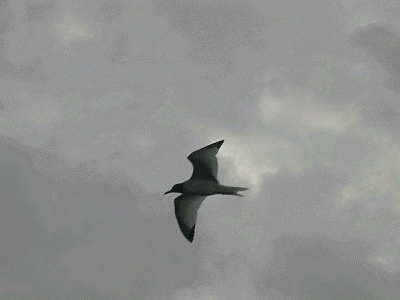
camouflage. We saw an amazing assortment of birds, two of which were very
special: the magnificent frigate bird which is all black but for—in the
males—an inflatable red throat pouch. The bird is elegant, large and
streamlined in its flying. It soars over other birds. We also saw the quetzal
bird, important to the Aztecs and Mayans, now the national bird of Guatemala.
The male has a glittering green plumage set off by a crimson belly and white
tail feathers contrasting with bright green tail converts that stream beyond
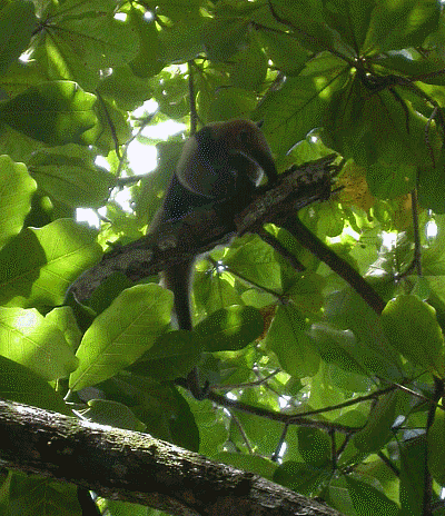
the bird’s body. We saw numerous monkeys and could not help but hear the
aptly-named “howler” monkeys. It was an extraordinary morning.
Next
morning we were ready for another shuttle to Montverde, about three hours from
Arenal, and known for its lovingly preserved cloud forests. Cloud forests
differ from rain forests in the delivery of water: cloud forests have continual
mist; rain forests have a stronger intensity of rain. We were fortunate to
spend a magical morning in the cloud forest under the tutelage of a remarkable
guide. With the help of his eyes we were able to see plants and animals galore.
More than 35,000 species of insects have been recorded in Costa Rica;
butterflies and moths are so abundant that Costa Rica claims 10% of the world’s
butterfly species. The dazzling, distinctive morpho butterfly has electric blue
upper wings with a 15cm wingspan. It is so beautiful. When this butterfly lands
the wings close and only the brown underwings are visible causing instantaneous
camouflage. We saw an amazing assortment of birds, two of which were very
special: the magnificent frigate bird which is all black but for—in the
males—an inflatable red throat pouch. The bird is elegant, large and
streamlined in its flying. It soars over other birds. We also saw the quetzal
bird, important to the Aztecs and Mayans, now the national bird of Guatemala.
The male has a glittering green plumage set off by a crimson belly and white
tail feathers contrasting with bright green tail converts that stream beyond
the bird’s body. We saw numerous monkeys and could not help but hear the
aptly-named “howler” monkeys. It was an extraordinary morning.
 The
last four days of our trip allowed us to see the Corcovado National Park,
located not far from our boat in Golfito. This park is on the Osa Peninsula,
upon which is found “Drake’s Bay,” where Sir Francis Drake supposedly visited
in 1579 during his circumnavigation in the Golden Hind. We had anchored on Moira
right there for several days, a couple of weeks earlier. We wound up in La
Paloma Lodge in the Corcovado Park because my cousin Wendy, and her husband
Barry, were visiting Costa Rica and they had made reservations there.
<Larry: I would have much preferred to sail back there from Golfito, anchor
again in Drake’s Bay, and visit with Wendy and Barry that way, but we couldn’t
make the schedule work.> We were able to secure concurrent reservations and
join them in this lovely place. The park was amazing for the different types of
animals. We saw monkeys, anteaters, sloths, tapirs (looks like a shetland
pony), scarlet macaws, and hummingbirds. We never did see a jaguar, which are supposedly
present in the immense rain forest. We spent another idyllic day snorkeling in
the waters around Isle del Caño, an island about 12 miles off the coast, which
is home to giant schools of barracuda, sharks, grouper and manta rays. While
the water was rich with plankton and the visibility mediocre, we did see a
manta ray and lots of tropical fish, all very colorful.
The
last four days of our trip allowed us to see the Corcovado National Park,
located not far from our boat in Golfito. This park is on the Osa Peninsula,
upon which is found “Drake’s Bay,” where Sir Francis Drake supposedly visited
in 1579 during his circumnavigation in the Golden Hind. We had anchored on Moira
right there for several days, a couple of weeks earlier. We wound up in La
Paloma Lodge in the Corcovado Park because my cousin Wendy, and her husband
Barry, were visiting Costa Rica and they had made reservations there.
<Larry: I would have much preferred to sail back there from Golfito, anchor
again in Drake’s Bay, and visit with Wendy and Barry that way, but we couldn’t
make the schedule work.> We were able to secure concurrent reservations and
join them in this lovely place. The park was amazing for the different types of
animals. We saw monkeys, anteaters, sloths, tapirs (looks like a shetland
pony), scarlet macaws, and hummingbirds. We never did see a jaguar, which are supposedly
present in the immense rain forest. We spent another idyllic day snorkeling in
the waters around Isle del Caño, an island about 12 miles off the coast, which
is home to giant schools of barracuda, sharks, grouper and manta rays. While
the water was rich with plankton and the visibility mediocre, we did see a
manta ray and lots of tropical fish, all very colorful.
We were ready to return to the boat. A three-hour taxi ride on atrocious roads brought us back to Golfito and home to Moira. But the rainy season was coming on us quickly. Not only was the heat and humidity increasing but it would rain several hours a day mostly in the late afternoon. The amount of rain would continue to increase. During the rainy season here an average of 24 inches falls each month. We were ready to face the journey to Ecuador leaving the rainy season behind us in order to secure the delightfully cool weather of Ecuador during the Southern Hemisphere’s winter.
The Gulf of Panama
 A
rough passage to Ecuador awaited us. The question is whether the e-ticket ride
is worth the results on the other side. The benefits of Ecuador would be the
temperature and climate as well as the good geographical position to tour South
America, which neither of us had seen. We were both interested in touring Peru
(Machu Picchu), Chile (all those glorious wines we have been drinking for two
years have a home) and Argentina (I still remember several friends’ glowing
reports of the beauty of Buenos Aires).
A
rough passage to Ecuador awaited us. The question is whether the e-ticket ride
is worth the results on the other side. The benefits of Ecuador would be the
temperature and climate as well as the good geographical position to tour South
America, which neither of us had seen. We were both interested in touring Peru
(Machu Picchu), Chile (all those glorious wines we have been drinking for two
years have a home) and Argentina (I still remember several friends’ glowing
reports of the beauty of Buenos Aires).
It is important to understand that there are two main ways to sail: down wind and up wind. Down wind allows the wind to push the boat from behind. It is the “gentleman’s way” to sail and the desired method to circumnavigate the world. <Larry: The old phrase is, “Gentlemen do not sail to weather (upwind).”> That’s why so many cruisers “turn right” to the Marquesas after a couple of years along the Pacific coast. Downwind, the winds are gentle, the motion of the boat is a gentle roll, and the wear and tear on the boat and crew is minimal. <Larry: Upwind, not: the boat’s speed is added to the wind’s speed, the waves come from ahead more frequently and steeply, with more water over the deck, and the motion becomes, well, lively.>
Alas, not every place you might want to go is downwind. Season, geography, and wind direction all conspire to determine whether a down wind or up wind passage comes along. Ecuador is directly south of Costa Rica. The winds after March turn to the south and southwest. This is also affected by the Inter Tropical Convergence Zone (ITCZ, or “doldrums”) <Larry: which migrates more-or-less in concert with the migration of the sun.> North of this zone, the winds are from the north <Larry: and therefore a southbound passage is downwind north of the ITCZ>; south of this zone they are from the south <Larry: and therefore a southbound passage is upwind south of the ITCZ>, in the range of 15 to 20 knots. This zone divides the oceans in the vicinity of the equator. The zone itself is an area of little winds and lots of rain. <Larry: And frequently, much lightning. One lightning strike can disable $10,000 worth of electronics. No fun. Let’s be net: the later you wait in the northern spring, the more contrary winds you’ll have.>
 We were
somewhat late in the season for our trip to Ecuador. By the time we started in
the first week of May, the ITCZ was far north, adjacent to Costa Rica, and the
winds we faced were south westerly. <Larry: Winds are labeled by the
direction whence they come, so south westerly winds come from the south
west. So the section labeled “North of the ITCZ, the winds are behind you”
effectively didn’t exist for us, and we got only the “South of the ITCZ, you go
upwind” part.> Larry had set us up well by leaving from Costa Rica rather
than Panama because in our westerly position we did not have to change course
throughout the trip. <Larry: Those who sailed from Panama had to zig-zag
into the wind, sometimes having to sail two miles through the water to make
good one mile toward their destination. We at least were spared that, and had a
favorable current to boot. In fact, we very nearly made Ecuador in one long
tack from Costa Rica.> But we were to face for the entire ride the winds
coming at the bow of the boat…we had to grind into the winds.
We were
somewhat late in the season for our trip to Ecuador. By the time we started in
the first week of May, the ITCZ was far north, adjacent to Costa Rica, and the
winds we faced were south westerly. <Larry: Winds are labeled by the
direction whence they come, so south westerly winds come from the south
west. So the section labeled “North of the ITCZ, the winds are behind you”
effectively didn’t exist for us, and we got only the “South of the ITCZ, you go
upwind” part.> Larry had set us up well by leaving from Costa Rica rather
than Panama because in our westerly position we did not have to change course
throughout the trip. <Larry: Those who sailed from Panama had to zig-zag
into the wind, sometimes having to sail two miles through the water to make
good one mile toward their destination. We at least were spared that, and had a
favorable current to boot. In fact, we very nearly made Ecuador in one long
tack from Costa Rica.> But we were to face for the entire ride the winds
coming at the bow of the boat…we had to grind into the winds.
Now, the problem with beating is the strain on the boat and the crew. Moira is a strong, tough boat who took these winds in stride and simply persevered. I think the boat was very happy. It was the passengers, or at least the first mate, who suffered. The noise is the distraction and irritant. The noise is incessant and never-ending. During the day and night the boat is bashing through the seas and the wind is howling through the rigging. After three days of this, I couldn’t sleep, the normal sleep patterns broken by the noise and the harsh motion. <Larry: There were periods of what they call “confused seas,” about 12 hours long on each of two consecutive days. The seas were never very high, maybe 4-6 feet at most, but with no regularity, sort of like the surface of a cheese grater. The experience was rather like riding in a family sedan on a very bad, rutted, potholed road. Constant motion and jostling made it tough to get any rest.> I was a basket case, so Larry (who would admit to not feeling so chipper himself because of the motion) parked the boat in a technique known to sailors as “heaving to." The smaller head sail is backed against the reefed main sail <Larry: effectively, the two sails wrestle each other to a standstill> and the boat sits into the wind in its own wake quite as a duck sitting on the water, with the sound, motion and waves going around it but not bothering or touching the boat. The forward movement and motion stop and its possible not only to cook a meal in peace but also to sleep like a baby. We spent 8 hours like this and both felt like we could face the wind and motion again. <Larry: One can’t do that every night, or one would never get anywhere. And stopping along the Colombian coast is Not Advised because of the drug trade and miscellaneous armed robbery at sea, also known as piracy. But every now and then, a “time out” is welcome.>
One good part of the trip was that with a constant 20 knots, even if close hauled, we were usually made 5 to 6 knots of speed. Our progress down the route to Ecuador was good. The current was good to us and we were not hindered by the fierce counter-currents experienced by many cruisers coming from further east.
For two days before the Equator we experienced the rains of the ITCZ. I have never seen it rain so hard. The rain came down so hard that I could hardly see two inches in front of me. Just amazing. Now this rain is not cold; rather it is warm and soft. In fact, I took one of my daily showers on the deck of the boat with a bottle of Joy and the rain from the skies. The rain poured down and came in torrents over the sails and rigging. It washed the boat free of salt and showered me nicely with lovely soft water. Once we escaped from the ITCZ, the weather improved and be began to see some blue sky, a little picture of what Ecuador would bring. <Larry: We burned twice as much fuel charging the batteries on this trip as we burned to push the boat: we used about 10-15 gallons of diesel fuel for propulsion to cover the 700 miles.>
 Before
we knew it we had passed the half way mark, and the Equator was soon upon us.
While we did not stop for a traditional King Neptune ceremony, we did each have
tot of rum <Larry: at 8AM> and provided King Neptune with his own brief
liberation. <Larry: Moira is a Greek name, so perhaps it was Poseidon
who got the offering.> So the world lost a couple of pollywogs and gained a
couple of shellbacks.
Before
we knew it we had passed the half way mark, and the Equator was soon upon us.
While we did not stop for a traditional King Neptune ceremony, we did each have
tot of rum <Larry: at 8AM> and provided King Neptune with his own brief
liberation. <Larry: Moira is a Greek name, so perhaps it was Poseidon
who got the offering.> So the world lost a couple of pollywogs and gained a
couple of shellbacks.
All in all the passage took seven days for 700 miles, our longest passage to date. On the morning of the 8th day we could see the land and by midday we were moored in Puerto Lucía. It was interesting to me that our entire voyage through Central America had prepared me for the passage from Costa Rica to Ecuador. It was the experience of the high winds and noise of Nicaragua that made me realize that our boat was strong and safe; the passengers had to get used to the rest. I knew Moira would get us there safely, but still the passage was long and grueling. When the wind dropped for several hours occasionally, the noise dropped, and the passage was almost pleasant. On the whole, I am now convinced that I will be a down wind sailor, and I will try to see that our desires of travel and the history of the winds coincide in a better fashion. If every passage were a beat into the wind, I probably would not be sailing long. Fortunately upwind passages are rare and I think that this particular passage will be remembered as our most arduous and difficult.
Ecuador
It was hard work but we finally got to Ecuador . Our expectations have been met. The climate is delightful and we are well situated to enjoy South America by land.
Additional photos from this season can be found in our Photo Gallery and Moira’s Ship’s Store.
Statistical summary of the second season in Mexico and Central America
- Time period: November 16, 2005 to May 10, 2006 (175 days, about six months).
- Distance covered: about 2,500 nautical miles (nm) or about 2,900 statute miles. About 14.3 nm/day or 100 nm/week.
- Longest single passage: Golfito, Costa Rica to La Libertad (Salinas), Ecuador, about 710nm, in 7 days, 3 hours (9:00am 5/3/2006 to 12:00pm 5/10/2006).
- Nights: In marinas: 83 nights (including 15 nights on moorings). At anchor: 67 nights. Under way: 21 nights. 55% of nights not under way were in marinas, 45% of nights not under way were at anchor. Of the 83 nights in marinas or on moorings, roughly xx were spent off the boat, touring inland or back in the States. We also left the boat overnight (actually, for 10 nights) on her own hook for the first time.
- Power vs sail: we covered 51% of the distance under sail, 49% of the distance under power (based upon 224 hours of engine use at 5.5kts under power = 1232 nm). These figures correct for time spent running the engine solely to charge the batteries.
- Fuel (diesel) usage: 241gallons, and after adjusting for time spent running the engine solely to charge the batteries, about 5+ mpg (for the miles under power) or about 1 gph.
Obiter Dicta
<Larry: The “Ten Essentials:” Susan asked me to list ten books that she could read that would give her a basic education in sailing and cruising—as much as could be gotten from books, anyhow. Herewith my list. Many of these are out of print, but may be available used, e.g., through Amazon.
Sailing theory, boat handling, seamanship:
- Creagh-Osborne, This is Sailing (Norton/SAIL series. The “Norton/SAIL” series are very basic, heavily illustrated books that came out in the mid-70’s, excellent for building the fundamental mental models.)
- Sleightholm, Better Boat Handling
Cruising:
- Sleightholm, This is Basic Sailboat Cruising (Norton/SAIL series)
- Wales, SAIL Book of Commonsense Cruising
Heavy weather:
- Bruce, This is Rough Weather Cruising (Norton/SAIL series)
- Pardey, Storm Tactics Handbook
Encyclopedias, either
- Leonard, Voyager’s Handbook
or
- Roth, How to Sail Around the World (terrible title, good book, really the 2nd edition of his After 50,000 Miles)
And then
- Dodds, Modern Cruising Under Sail (I disagree with most of what he says, but he asks the right questions and forces one to defend conventional wisdom)
Attitude Adjustment:
- Coote, Total Loss (FIRST edition, if you can find it, second edition is OK)
- Kals, Practical Boating, especially the first chapter
And if I got to name a few more, I’d add:
- Dashew, Practical Seamanship (Sloppy editing, but a solid book once one gets past the typo’s)
- Dashew, Offshore Cruising Encyclopedia (Ditto)
- Clemens, Contingency Seamanship
- Van Sandt, Gentleman’s Guide to Passages South (first third or so, the geography-independent stuff, priceless descriptions of the personality types one meets on the road to nowhere, and a fine geography-independent discussion of coastal micro-weather effects under “Playing the island lees”.)
Cruising music. People say that Jimmy Buffet is the cruiser’s balladeer. Well, maybe. But if you want to listen to music of the hardcore water-dweller, listen to Eileen Quinn.>
![]() Rate this page
(CentralAmerica.htm)
Rate this page
(CentralAmerica.htm)